HuntsSOlO

Home

Property Layers

Map Data Layers

Free & In-App

Planned Features

Contact


A Hunting App Designed to Do 2 Things:

        Respect your Privacy.

        Meet the Need, no more.

Privacy:	No membership or signup required.
Access to your location is requested by the App for the purpose of setting Google Maps coordinates and user-initiated track record recording. HuntsSOlO does not collect, transmit or otherwise handle GPS location data beyond user-initiated usage within the App, on your device.


Need:	Save point locations (Marks), draw lines and polygons, and log your location with a tracking feature (Track).
Map layer data available for select states.
	Property lines and owner data.
	Public lands data.
	Hunting districts and wildlife management regions.


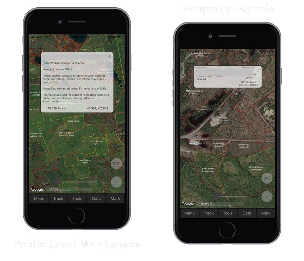
States with Map Layer Data:

National Wildlife Lands and Easement layers available for the 48 contiguous states.

Property Parcel layers available for 25 states, click the Property Layers tab for details.

Game Management District layers (also classified as Zones, Units or Areas) available for 23 states, click Map Data Layers for details


HuntsSOlO